
|
GPS AGL Altitude Blank?!?! |
Post Reply 
|
| Author | ||
jimmyz80 
Groupie 

Joined: 24 Jul 2016 Location: Folsom, CA Status: Offline Points: 86 |
 Post Options Post Options
") Thanks(0) Thanks(0)
 Quote Reply Quote Reply
 Topic: GPS AGL Altitude Blank?!?! Topic: GPS AGL Altitude Blank?!?!Posted: 13 Sep 2017 at 9:37pm |
|
|
Is there any reason why one of my IFDs would show the GPS AGL altitude as being blank, yet my other IFD shows a correct number? The really weird thing is, if I go into the datablock setup page and highlight that datablock, it seems to go back to normal for a minute or two before blanking out again.
Between this datablock being blank, and the decoded NAVAID datablock being blank, I'm not really feeling the datablock love here... 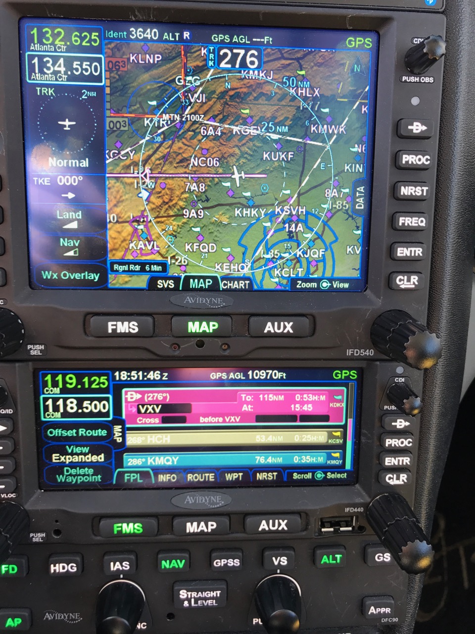 |
||
|
2006 Cirrus SR22 - IFD540 IFD440 DFC90 AXP322 MLB100
|
||
 |
||
|
oskrypuch
Senior Member 
Joined: 09 Nov 2012 Location: CYFD Status: Offline Points: 3058 |
Post Options
Thanks(0)
Quote Reply
Posted: 14 Sep 2017 at 8:45am |
|
|
I have never seen either be blank, when it shouldn't be. In particular if only one of your units shows this, you may have some sort of hardware fault.
* Orest |
||
|
||
|
AviSimpson
Senior Member
Joined: 31 Mar 2015 Location: Lincoln, MA Status: Offline Points: 765 |
Post Options
Thanks(0)
Quote Reply
Posted: 14 Sep 2017 at 3:08pm |
|
Did you ever get a GPS CAS message like "Dead Reckoning"? Can you confirm that the 540 has the FLTA option highlighted on the AUX page?
|
||
|
Simpson Bennett
Avidyne Corporation Product Manager |
||
|
||
|
pburger
Senior Member
Joined: 26 Dec 2013 Location: United States Status: Offline Points: 406 |
Post Options
Thanks(0)
Quote Reply
Posted: 14 Sep 2017 at 6:20pm |
|
|
Total guess, but I wonder if it has something to do with available space. The 540 has the transponder info, which somehow might be squeezing the GPS AGL block such that it can't fit the 5 digits of the altitude?
|
||
|
||
|
jimmyz80
Groupie
Joined: 24 Jul 2016 Location: Folsom, CA Status: Offline Points: 86 |
Post Options
Thanks(0)
Quote Reply
Posted: 14 Sep 2017 at 7:08pm |
|
No CAS messages at all, other than expected alerts for airspace, tank switching, etc. I'll check the AUX page when I'm at the plane again on Sunday. For what it's worth, I've only noticed this post 10.2. Prior to that it worked perfectly. I'm wondering if the CPU is overloaded in the unit or something. I've also noticed that when I change zoom levels on the map page, it'll sometimes take 10-15 seconds to re-draw things. For example if I zoom in when I'm near a fix that has an altitude restriction of "3000". The entire map will be filled with a GIANT label of 3000 until it re-draws to normal size in 10-15 seconds. It's not very confidence inspiring, considering this is my NAV1 unit, which I bet my life on when flying precision approaches.
|
||
|
2006 Cirrus SR22 - IFD540 IFD440 DFC90 AXP322 MLB100
|
||
|
||
|
oskrypuch
Senior Member
Joined: 09 Nov 2012 Location: CYFD Status: Offline Points: 3058 |
Post Options
Thanks(0)
Quote Reply
Posted: 14 Sep 2017 at 8:00pm |
|
|
That is normal when rapidly resizing the map. The labels may be a little large or a little small for a bit until it rewrites.
* Orest |
||
|
||
|
AviSimpson
Senior Member
Joined: 31 Mar 2015 Location: Lincoln, MA Status: Offline Points: 765 |
Post Options
Thanks(0)
Quote Reply
Posted: 15 Sep 2017 at 10:18am |
|
Good guess but it would manifest on both units if that was the case. The datablock is the same dimensions (pixel wise) on both.
|
||
|
Simpson Bennett
Avidyne Corporation Product Manager |
||
|
||
|
AviSimpson
Senior Member
Joined: 31 Mar 2015 Location: Lincoln, MA Status: Offline Points: 765 |
Post Options
Thanks(0)
Quote Reply
Posted: 15 Sep 2017 at 10:25am |
|
Since we made changes to the options, like FLTA, page it's possible that it is no longer highlight for some reason. It's an easy fix on our end.
What ranges are you going from and to when you see this? How far are you panning, if at all, from your current location? What declutter, if any, do you have the map set to? It's inevitable that there is going to be a delay, 15 seconds sounds excessive.
|
||
|
Simpson Bennett
Avidyne Corporation Product Manager |
||
|
||
|
Post Reply
|
|
 Tweet
Tweet
|
| Forum Jump | Forum Permissions You cannot post new topics in this forum You cannot reply to topics in this forum You cannot delete your posts in this forum You cannot edit your posts in this forum You cannot create polls in this forum You cannot vote in polls in this forum |


 Topic Options
 jimmyz80 wrote: